Digitalní archív orienťáckých map pro Rebecca Harding
|
Přihlásit
Všichni uživatelé
|
Jazyk:
Česky
Česky
Dansk
Deutsch
Eesti
English
Español
Français
Italiano
Magyar
Norsk
Português
Svenska
Türkçe
|
DOMA 3.0.6
Zobrazit náhled na Google mapě
Skýt náhled na Google mapě
|
Otevřít v Google Earth
|
Zpět
<< BUCS Relay (24.02.2013)
|
SOL 1 Part 2 (03.03.2013) >>
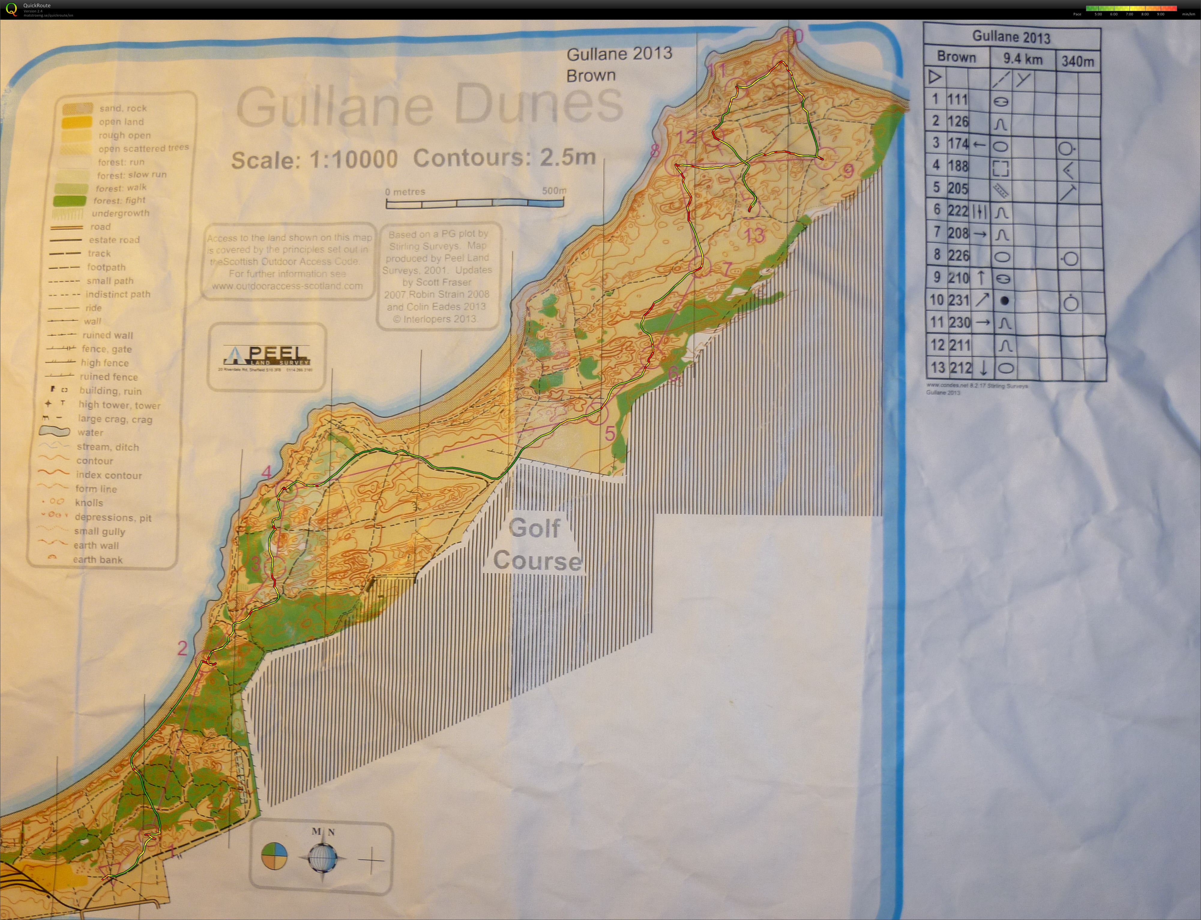
SOL 1 (03.03.2013)
Kategorie:
Competition
Mapa/oblast:
Gullane
Pořadatel:
Intelopers
Skutečná délka:
5.05 km
Čas:
35:03
Prům. tepy:
162
Max. tepy:
175
My aim was to visualise from my attackpoint into the control. This requires forward planning and knowing what to expect.
It was a bit slow/the process needing warming up, I missed one slightly despite knowing what to look for; the depression over the hill and slightly north of the re-entrant. The process was generally there using the control descriptions and deciding what I would see on my way in. However occasionally it wouldn't happen because I wasn't using time on the legs to effectively plan and visualise.
Zobrazit komentáře
Skrýt komentáře
(
0
)
Napiš komentář
Jméno:
Email:
Ulož
 Česky
Česky Dansk
Dansk Deutsch
 Eesti
Eesti English
 Español
 Français
 Italiano
 Magyar
 Norsk
Norsk Português
 Svenska
 Türkçe